CASE STUDY
PARTNER: KIMLEY-HORN
CLIENT: CITY OF LONE TREE, COLORADO
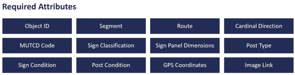
PROJECT: TRANSPORTATION ASSET MANAGEMENT CONSULTING
APPLICATION: TRAFFIC SIGN INVENTORY AND CONDITION DATA
EXTENT: 100 LANE-MILES
Engineers at Kimley-Horn have been providing asset management consulting services for many roadway agencies across the US. The transportation asset management process helps agencies make the best use of their taxpayers’ money in maintaining and improving their infrastructure network. This process typically involves asset inventory, condition evaluation, performance prediction, treatment selection, prioritization, and optimization of budget allocation. Kimley-Horn engineers use this data-driven process to provide decision-makers with short and long-term maintenance and capital improvement plans. iENGINEERING has recently developed a new service line of transportation engineering software, known as Transconomy, that automates and accelerates data processing activities for agencies and their consultants. Using Artificial Intelligence (AI), Transconomy Asset software is capable of automatically detecting and classifying traffic signs according to the Federal Highway Administration’s (FHWA) Manual for Uniform Traffic Control Devices (MUTCD), other point assets (such as light posts, utility poles, fire hydrants, etc.), line assets (such as guardrails, medians, barriers, etc.), and many more asset types.
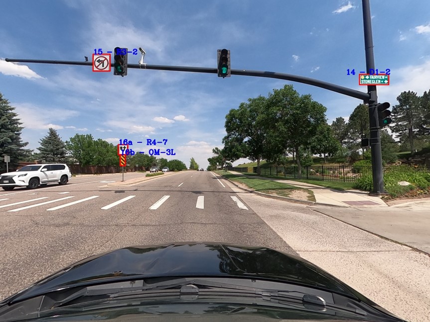
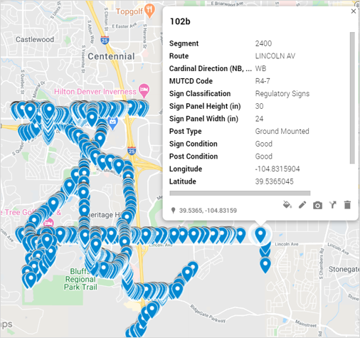
iENGINEERING and Kimley-Horn joined forces to create a traffic sign inventory and condition database for the City of Lone Tree, Colorado. Kimley-Horn was proud to partner with iENGINEERING on a data collection project for the City of Lone Tree, Colorado. In addition to traditional automated collection methods for the City’s pavement inventory, Kimley-Horn was also tasked with collecting imagery and performing condition assessments for over 4,000 traffic signs within the City’s boundary. The City was interested in establishing a baseline inventory of the signs, including initial condition assessments on a 1 to 4 scale, with associated and geo-tagged imagery for each sign. This challenge was heightened by not being able to collect imagery via drones or LIDAR methods, due to the proximity of an airport, the layout of adjacent neighborhoods, and COVID-19 concerns. iENGINEERING partnered with Kimley-Horn by utilizing a robust machine-learning software system and careful, yet rapid processing of thousands of images. The data collected provides a basis for the City’s sign inventory along with a tremendous ability to forecast annual budgeting for sign repairs and replacements. Staff at Kimley-Horn collected about 100 lane miles of street imagery using a GoPro camera with instructions provided by iENGINEERING to ensure the quality and consistency of the video log. Nearly 50,000 Images were then uploaded to the cloud (Transconomy Hub), where the Transconomy AI algorithm was executed. These raw images were automatically processed to identify assets, remove duplicate assets in consecutive images, and geo-tag asset locations on a map. The software provides the GIS-based asset inventory in Shapefiles (SHP) for use in Esri applications and Keyhole Markup Language (KML) files for use in Google applications.
In addition, in collaboration with Kimley-Horn engineers, iENGINEERING staff used a semiautomated approach to determine the condition of sign faces and signposts for this project. In addition to the GIS files, all data were also delivered in comma-separated value (CSV) file format to the City.
Overall, the City was pleased with the results, citing the project team was “responsive to the needs, concerns, and wishes of the Lone Tree community, including our internal stakeholders. The firm’s skilled and dedicated professionals have provided exceptional service to the City.”
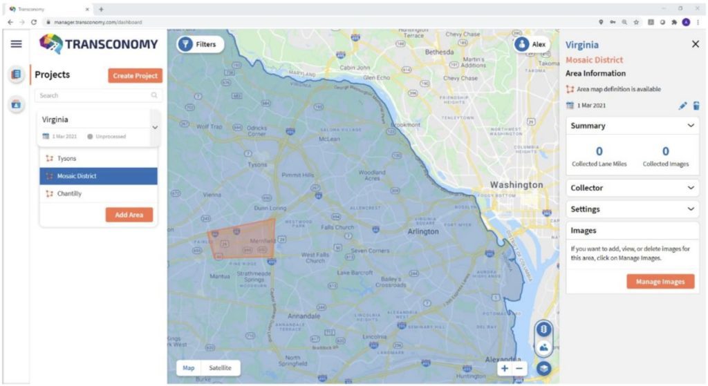
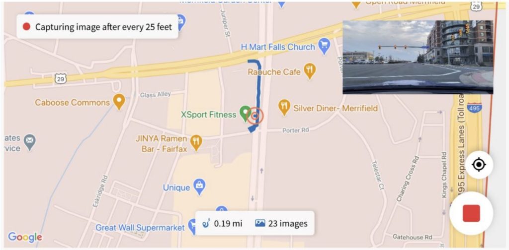
Since this project, a mobile application (Transconomy Collector) has been released, which allows the automated collection of roadway images using Android or iOS cell phones. The image-capturing frequency can be specified in temporal or spatial format on the Transconomy Manager web application and different collectors can be assigned to various areas under each project. Images are synced to the cloud to be displayed on the web application. Users can run the AI algorithm on Transconomy Manager to automatically detect and classify roadway assets and download the results in CSV, SHP, and KML file formats.
In future projects, Kimley-Horn may utilize this automated AI-enabled software for processing roadway image data to create complete asset inventories for their client organizations, including State and local highway agencies, metropolitan planning organizations, and other transportation asset owners.