Plan
Roadmap lets you conveniently configure the project parameters and divide your network-level project data into manageable areas. Allocate these areas to your data collection drivers (collectors) and specify a spatial or temporal frequency for image capturing.

Collect
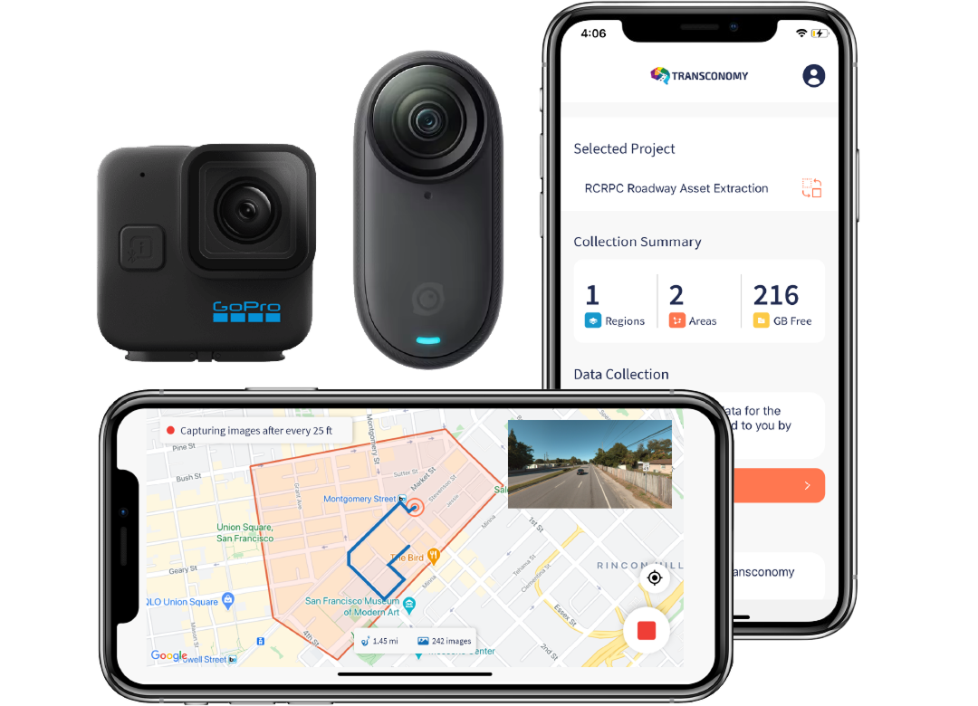
Collectors can use Collector/Navigator to navigate and collect roadway images in their assigned areas. The collection can be done using the application or mounting external cameras that collect images. These images collected using the application will be uploaded directly to the cloud-based Roadmap using cellular data to sync as you drive or a wireless network connection to sync after collection.
Process
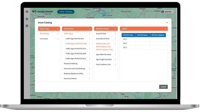
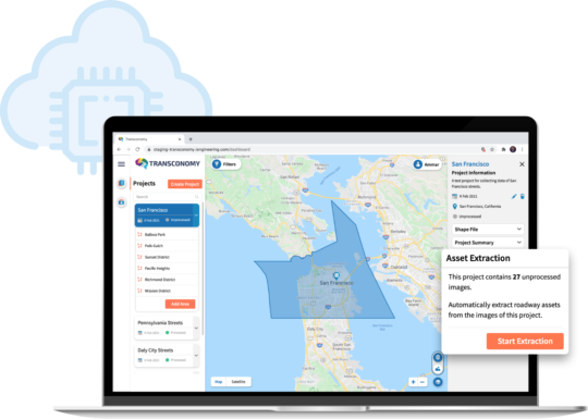
After collection, the images collected via external cameras are uploaded to the Roadmap application. With data validation checks performed our AI-powered algorithms can automatically extract various roadway assets. Transconomy identifies over 250 traffic signs and more than 30 other line (continuous) and point assets to compile a comprehensive inventory based on relevant specifications.
Visualize
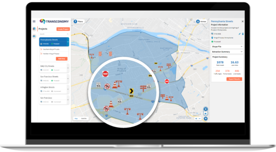
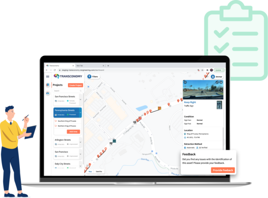
Roadmap has a viewer functionality to plot all your assets on an interactive map and provides roadway images annotated with identified assets for enhanced visualization. You can quickly review all the details about any asset by simply selecting them on the map.
Validate
You can commission our team or your trusted consultant to conduct partial or comprehensive quality control (QC) of the results and/or to assign condition information to the identified assets.
Integrate
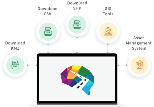
Asset inventories created by Transconomy can be easily downloaded and integrated with your preferred GIS and asset management software. Just select your desired file format (CSV, SHP, and/or KMZ) and hit download.